Thursday, April 28, 2011

Super Tornado Outbreak 4/27/11

Edit: I haven't seen a final death toll in a while and there were still several people missing(>100) last I heard, but I am going to put in a number that I heard last and that was 341 people killed and still some 100 people missing. Total damages are in the billions.

On Wednesday April 27th, 2011, a massive tornado outbreak occurred in the southeast U.S. As of this writing, there are 285 confirmed deaths and nearly 2000 injuries that have occurred in mainly six states. 207 died in Alabama, 34 in Tennessee, 33 in Mississippi, 15 in Georgia, 5 in Virginia, and 1 in Arkansas.
Alabama was particularly hard hit by several long track violent tornadoes. Many small communities were basically wiped off the map, and Tuscaloosa and the northern suburbs of Birmingham were also hit. Initial ratings have started to come out with a couple high end EF-4's already. So far there are no ratings for the Tuscaloosa and Birmingham tornadoes, but it is believed they were at least EF-4 and possibly an EF-5.
This day and storm system was forecast for days. The Storm Prediction Center had a high risk outlook for the areas of Alabama, Tennessee and Georgia the day before. Some of the composite indices used to gauge potential severe weather were literally off the charts. Often times, severe weather outbreaks that are forecast like this don't transpire to the possible levels that seem likely. However, this was one of those times where the large and violent tornadoes that were traveling across the countryside were hitting towns and hitting large cities as well.
Being someone who is obviously interested in weather and follows especially severe weather very closely, I was glued to the TV and internet all day. I watched the Weather Channel, even though I normally don't anymore, and I found the ABC channel out of Birmingham that was broadcasting over the internet on my computer. First off let me say both channels did an excellent job of broadcasting this event. TWC which has become a lot of times anything but weather stayed on the air for over an hour covering the tornado as it went from Tuscaloosa to Birmingham. I was watching on my computer as the local channel had a Tuscaloosa skycam up and watched with horror as the large tornado went into Tuscaloosa. It gave me chills to watch what was going on live before my eyes.
What's so horrifying about the numbers of casualties is this occurred with today's technology. Death tolls from severe storms like this haven't been seen since the 1970's and before. There were several factors that probably contributed to the high numbers of deaths. First. the sheer size and number of tornadoes that hit large populated areas. When tornadoes have winds over 200 mph the only way to survive is if you are underground. A lot of homes in the south do not have basements. Second, there are a lot more mobile homes in the South which provide no reasonable shelter. Third, there was a line of storms that went through earlier in the morning that took out numerous power lines, and communication towers. Also, supposedly one of the weather transmitter towers was taken out so warnings weren't being sent out to weather radios. The last thing I want to mention that almost certainly happened was complacency towards warnings. There will always be people who think when they hear a tornado siren that nothing is going to happen to them where they live. There have been numerous times when I have been out chasing, where I have seen people out walking their dogs, etc while tornado sirens were blaring in their city. People have got to learn to take warnings seriously!!
One other thing, I saw on the news tonight. There was a news reporter reporting from a particularly hard hit area in Tuscaloosa. It was low income housing district for people who receive government housing I believe. Most of these people have no vehicles to escape, no technology to receive warnings other than sirens, and again no basements for shelter. I believe more than 10 people died in this subdivision alone.
April 27th was a sobering, and utterly horrifying day to watch unfold. There were many times today where I was having to fight back tears watching and listening to some of the stories of the victims. I know this will be a day I will remember for a long time.
I'm going to post some of the radar images that I saved, and also links to stories and videos. As the storm surveys come out I will post those as well.


Tuscaloosa 509 pm

Storm Relative Velocity Tuscaloosa 509 pm

Tuscaloosa 513 pm

Tuscaloosa 517 pm

Storm Relative Vel Tuscaloosa 517 pm

538 pm

538 pm

555 pm nearing Birmingham

555 pm close up- the purple circle is a debris ball!!

616 pm north of Birmingham. the red nearly complete circle is the circulation

616 pm SRV north of Birmingham


a classic example of yet another hook echo on a supercell in Alabama

videos:
http://www.youtube.com/watch?v=5ohIVzIZLuQ&feature=player_embedded -very close up video of tornado going near the University. guy sounds very scared throughout and at the end seems like he is crying and shaking. one of the most intense videos i've seen, and the human emotion at the end is raw
http://www.cbs42.com/mostpopular/story/Tuscaloosa-tornado-caught-on-tape-wreaking-havoc/hsK7dFmlUku5YlvteTFy6A.cspx -news station clip of tornado entering Tuscaloosa
http://www.youtube.com/watch?v=TIx26tN6pCk&feature=player_embedded - close call with tornado in tuscaloosa, lady comes running up to car near end of video hysterical
ground scouring Philadelphia, MS EF-5 tornado

damage surveys:
Birmingham WFO: http://forecast.weather.gov/product.php?site=BMX&product=PNS&issuedby=BMX
Jackson, MS WFO: http://www.srh.noaa.gov/jan/?n=2011_04_25_27_svr
http://www.srh.noaa.gov/jan/?n=2011_04_25_27_SVR_PNS
Atlanta damage survey
Huntsville, MS WFO
Eastern TN damage survey

Wednesday, September 15, 2010

Omaha shelf cloud 9/15/10

a nice little severe storm blew threw omaha with 60 mph winds and penny to quarter sized hail. i worked til 7 and watched the storm on the radar. unfortunately, i waited too long to get out to take some pics, so i had to kindof take pics while driving. it was one of the cooler looking storms i've seen in quite a while! you could really see the rotation of the storm as it approached overhead, and on the northern edge of the storm where i was closer too at one point, there was scud rapidly rising in the updraft of the storm. sarah and i went north for a while before i could see that the storm was going to go further south so we went back south down 132nd street. we ran into very heavy rain and soon hail up to penny sized. it was coming down so hard that we had to pull over in our church parking lot until it let up! we headed home, and as we were coming down our street we first noticed one tree that had a fairly large branch broken, and then 2 houses down from us we saw an entire 15-20 feet tall tree was uprooted from the ground. i wish i would have gotten out about 1o minutes earlier to get some better pics, but it was still a nice little storm!


radar grabs of the storm as it moved through the town


Friday, June 18, 2010

Best chase day ever(so far)!! Minnesota tornadoes 6/17/10

Today was it!! My dream chase day finally happened, even though for a while this day, it looked like it wouldn't. My new chase partner, Matt and I left town around 1 pm with an initial target of northwest Iowa up to southwest Minnesota. At one point we almost stopped heading north to go east into Iowa earlier, but decided to keep going up to I-90. storms had started firing about 300 pm, but were surprisingly further east into Minnesota than what I expected. Here's the risk area issued at 1130 am. we thought we would start on the western part of the red area, but everything formed almost in the middle of the moderate risk.

very large moderate risk area

high risk hatched area of tornado probabilities

very large hail chances were high too

later in the evening storms were going to transition to big wind event

i've included the link to the minneapolis nws damage survey page. the tornado reached a max intensity of EF-4!! appears this was during some of the pics and video we took!!

http://www.crh.noaa.gov/mpx/?n=10june17

here's my videos finally!! they were too big to just upload to my page, so i had to split it up and post them to youtube. there are three parts:

part 1: http://www.youtube.com/watch?v=YjTClVBdsSw
part 2: http://www.youtube.com/watch?v=S0wwjLX0Bx4
part 3: http://www.youtube.com/watch?v=nxqXRyXcCRg

according to the storm survey the tornado was at its strongest 2 miles north of Conger, MN. I have video of the tornado as we are going through Conger! highlights of the damage here include a car being thrown 3200 feet and trees completely debarked! the tornado continued on passing north of Interstate 90 and eventually grew to 1 mile wide!! Of note, the tornado was not as strong when it was at its widest, producing only EF-2 to EF-3 damage. this is a common misconception that the wider the tornado, the stronger the winds!
unfortunately one fatality occurred with this tornado, right after where we first had to turn around.

onto the pics!!

pic of storm growing as we approach south central minnesota

pic i did some crazy editing with!

close up of cumulonimbus exploding

again

again

we were now approaching the storms in central minnesota, and there was a tornado warning! unfortunately the radar on my computer was almost 30 minutes old, so we didn't know if it was entirely safe to drive through the storms on the interstate to get to the east side of the storms. we wanted to get in front of them to get a better view.

getting pretty close to the storms now near blue earth minnesota


huge hail shaft(white area) in storm crossing the interstate

we started to drive into the storm before deciding it would be better to not try it. i turned around on the interstate and we headed back west eventually finding another exit where we went south and back east towards blue earth, minnesota. we felt it was safe enough to start heading east again, despite the radar still being not up to date. as we were driving down the interstate, a wall cloud formed behind us, and we started to get into heavy rain again. here's a pic of the wall cloud:

so again we pulled off the interstate and sat and waited. listening to the radio, there were more storms down to the south of us that were warned for tornadoes. there was going to be no way to head east it looked like. we sat for about 10 minutes, watching the storms to our east and south. this was directly above us:


when suddenly looking south we saw the beginnings of a wall cloud on the horizon!

wall cloud and funnel starting to form

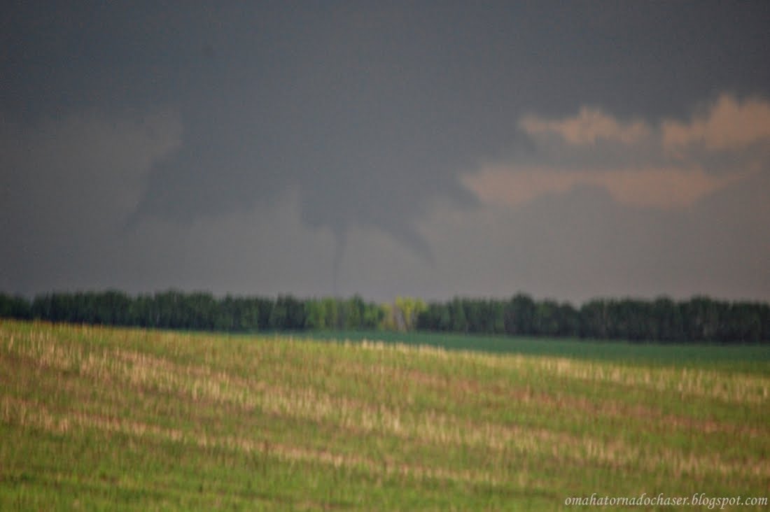
beautiful first tornado!!

starting to lift. this was actually already the 2nd tornado to form

still a good looking funnel!

2nd tornado dissipating

3rd tornado!!!

now a needle like tornado with several another funnel next to it!!

we were stopping and taking pics, driving forward for a while and stopping again to take more pics. the third tornado lifted, and now a massive wall cloud almost on the ground formed. it looked like a massive wedge was about to form. we were just west of bricelyn, minnesota now.

pic of large wall cloud

again

one more time

the black pickup was an emergency vehicle racing east towards bricelyn

we had to drop south briefly in bricelyn due to road network but then headed east and met up with the storm again. it was here where we ran into all the other chasers in the area including roger hill's tour group! we watched the meso rotate rapidly as one wall cloud to the right in the pic below tried to make another tornado.

dual wall clouds, the whole sky seemed to be rotating!!

huge rotating wall cloud

funnel forming!

suddenly a tornado on the left there comes out of the haze!! didn't even see it coming!

close up of tornado number 4!!


more pics of the 4th tornado


we caught back up with the storm, and the tornado was still on the ground. these are some of my favorite pics below:


got fairly close to the tornado below. the motion was so violent and there were almost always multiple vortices.


in the pics below there are storm chasers and other people right up next to the tornado


probably my favorite pic of the tornadoes

violent motion in the tornado!

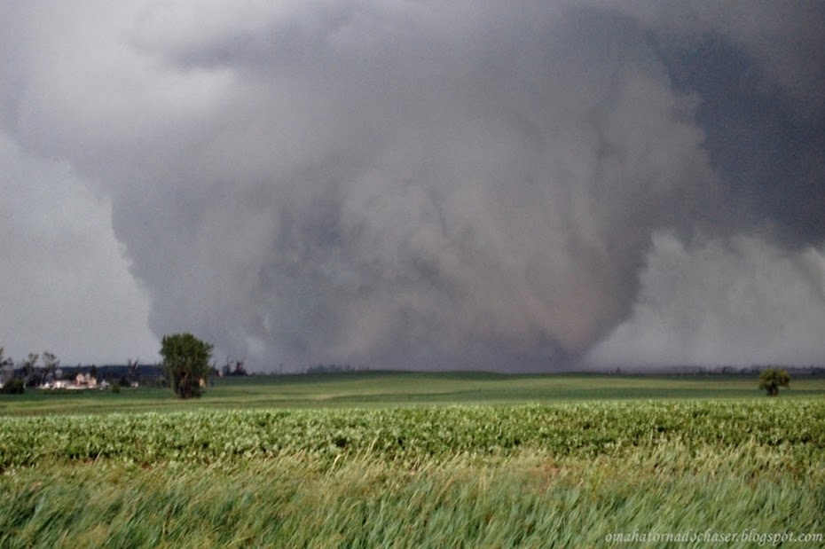
close up of violent tornado

multi-vortex tornado!!

could have been my favorite pic if it was less blurry!

the tornado was still on the ground as we now headed north. along the way we had driven through a couple of small towns, i believe conger, minnesota was one of them, that had some tree damage and some poles were leaning over, etc. as we headed north on hwy 46, we ran into a bunch of the other chasers turning around. there were tons of wires and power poles down across the road in front of us!! we had no choice but to turn around and therefore give up on the storm. we turned around in a driveway of a house that had this damage below:


we decided to start heading home towards omaha. it was now after 7 pm and we had been chasing the same tornado producing storm for at least an hour now. as we headed south we ran into a cell that was only severe warned at the time. suddenly the hail started. it grew and grew so at the end when only a few stones were falling, they were nearly golf ball sized. i finally put some dents into my car!!


after the storm passed the back side of the storm came into view and another large wall cloud was starting to form. again the rotation was amazing, and we were sure this would make another tornado on this new storm. we turned back around to follow this storm north. unfortunately this led us into albert lea minnesota. after a few wrong choices we finally ended up on the east side of town, almost to I-35 that would take us north to the storm again. there was now another report of a large tornado on the ground again! here we came up to a bridge and suddenly had to stop bc of cars stopped. there were a couple of cops sitting at the bottom of the east side of the bridge not letting traffic go any further east. rather than letting everyone go further another 100 feet where they could turn everyone back around to the west, THEY HAD US ALL SIT AND WAIT ON A BRIDGE, THE TALLEST STRUCTURE IN THE AREA!! soon the sirens started going off again, and the cops started coming up to us and saying it might be safer for us to get out of the car and walk down to the end of the bridge and go wait under the bridge. so we sat there for nearly 15 minutes. finally we said something to one of the cops about letting us go the 100 feet down the road so everyone can turn around. the one cop talked to the other and sure enough they finally let us go and turn around. we made a full loop, driving by the cops and started heading north again. there was still a report of a tornado on the ground about 10 miles northeast of albert lea. we tried to catch up to the storm again, but eventually ran into more power lines down so we had to turn around one last time. we started home happy but exhausted!! the tornadoes we saw today were the first my buddy matt has ever seen, and for me i had only "kindof" seen a tornado last year near kirksville. so this was the day i had dreamed of, seeing multiple tornadoes, moving slowly, with plenty of chances for pics and video!! what a day!!

new wall cloud forming on last storm

another shot of wall cloud forming

storm now past us moving north

last storm we tried to catch up to before we had to turn around again

shot looking back to the east towards des moines, along I-80. was trying to catch a big bolt, but of course those stopped when i stopped to get pics!

some videos taken by my chase partner matt!! i will hopefully add mine later, it's a lot longer though!

first good video matt took


2nd longer video as we get within 1 mile of the huge tornado!!


last video taken by matt of the tornadoes!

here are some of matt's pics taken. some are similar but i tried to pic out some different ones!

strong updraft on a thunderstorm

first tornado of the day!!

awesome shot of elephant trunk tornado!!

chasers close to tornado!

violent tornado!!